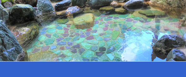
If you are wondering about where to spend your weekend wanting to get away from all the hustle and bustle then Hakone is exactly the right choice. With all its hot springs, spas and simply relaxing atmosphere it’s perfect for those who want to be a little lazy for once in a while. But what about those who are willing to move, explore and be as active as possible even while on a vacation? No need to worry, Hakone has something to offer for all those looking for an adventure. How about hiking? Does it sound good? We bet it is!
Let us introduce top 6 hiking trails in Hakone!
※Difficulty level ★ Easy ★★ Moderate ★★★ Challenging
★ Old Tokaido Stone Paved Road


Old Tokaido Stone Paved Road is also known as Tokaido Highway, it is one of 5 famous highways constructed in Edo period. In the past people used this road when they traveled between Edo and Kyoto.
It is a pretty easy hike which we recommend to all our guests. We recommend starting at Hakone Sekisho Site. Along the way you can enjoy being surrounded by stunning nature and beautiful forests of Hakone, including well known large cedar trees which are over 400 years old. Your journey will end near Amasake Chaya, where you can relax, get yourself some amasake (rice juice) and yummy rice cakes.
Time required: 1 h 30 min
Distance: 4 km
Starting point: Hakone Sekisho Site
Goal: Amasake Chaya
Hakone Town Tourism Association
Kanagawa Prefecture West Area Prefectural Government General Center(Japanese)
★ Lake Ashinoko East Bank course


This is a very easy course which is suitable for everyone. This part of Ashinoko feels more like a pleasant walk rather than actual hike. We recommend this course to everyone, including young children and elderly people. Along the way you can enjoy some pretty well known sightseeing spots, such as Kuzuryu Shrine, Hakone-en Resort Complex, Komagatake Ropeway and Hakone Shrine.
Time required: 2 h 30 min
Distance 7.5 km
Starting point: Hakone Visitor Center (Togendai Station)
Goal: Hakone-Machi Bus stop
★★ Lake Ashinoko West Bank course


Lake Ashinoko West Bank course is recommended for everyone who likes long distance walking. This is a course with a few ups and downs, and it takes about 4 hours to complete which can be pretty challenging for some people. There are some nice beaches along the way where you can have a break and take some nice pictures. Most of the time you will be surrounded by nature and forests, while walking you can observe some wild plants and birds. Please note that there are no toilets or convenience stores available along the way, so please make sure to prepare beforehand.
Time required: 3 h 50 min
Distance 11.5 km
Starting point: Hakone-Machi Bus stop
Goal: Hakone Visitor Center (Togendai station)
Source: Ministry of the Environment website (URL of the relevant page)
★★★ Mt. Kintoki Hiking Course


Being known as the origins of the Legend of Kintaro and having a spectacular view of Mt. Fuji, Mt. Kintoki is with no doubt the best and most popular hiking course Hakone can offer. Being 1,212m high, the 360 degrees wide panoramic view is overwhelmingly breathtaking. On fine days, Sengokuhara(A meadow of maiden silvergrass), Lake Ashi, and the steam of Owakudani can all be seen from the summit, along with the Tanzawa Mountains, Miura Peninsula, Mt. Izu Amagi and a variety of mountains of the Fuji-Izu-Hakone UNESCO registered Global Geopark.
Rest assured as there is an old tea house and rest area up in the summit that has been there since the Spring of 1947. They offer some traditional Japanese sweets, delicious noodles and such light food and a few drinks, too.
Time required: 2h 30min
Distance 4.6 km
Starting point: Kintoki Jinjya Iriguchi (Kintoki Shrine Entrance)
Goal: Kintoki Tozan Guchi (Kintoki Hiking Entrance)
Friendly Advice: Since there are quite a few entrances, make sure to confirm the name of the entrance in order not to get lost. Furthermore, due to the rocky path, we would recommend having gloves with you to hike with.
Source: Ministry of the Environment website (URL of the relevant page)
Founder Kintoki Tea House(Hakone Navi, Japanese)
★★★ Yusaka Hiking Trail Course (The Old Path to Kamakura)


Having been opened during the Heian Period(794 – 1185 AD), the Yusaka Trails alongside Ashigara Trails have been the two main paths a great many of people and travelers have taken up until the Tokaido Road has been finished in the Edo Period(1603 -1868). It is a historical course for anyone and it begins from Ashi no Yu, continuing to the following Mt. Takasu, Mt. Sengen and Yusaka Trails leading up to Hakone Yumoto.
If your stamina and time allows it, we would recommend making a little detour and visiting Chisuji falls, Motohakone’s Stone Buddha Statues as well as Otamagaike(A historical pond) along the hiking course.
Time required: 3 h 00min
Distance 6.5 km (double for back & forth)
Starting point: Ashi no Yu (Yusakaji Iriguchi / Yusaka Road Entrance)
Goal: Hakone Yumoto
Friendly Advice: There are no restrooms and restaurants on the way.
Going backwards will be a steep hike so we would not recommend it.
Kanagawa Prefecture West Area Prefectural Government General Center (Japanese )
★★★ Mt. Myojingatake Hiking Trail Course

© MIYAGINO KIGA HAKONE TOWN Tourist Association
Mt. Myojingatake is located in the eastern part of Hakone, pretty close to Mt. Kintoki, which was already mentioned in this article. This is the second highest mountain among the outer rim of a volcanic crater of Mt.Hakone and is very popular among hikers and nature lovers. At the summit of the mountain a stunning panoramic view awaits you. From the top you can see not only the entire Hakone area, including Owakudani and Sagami Bay, but also Mt. Fuji.
Time required: 3 h 30m
Distance: 7 km
Starting point: Miyagino Branch Bus stop
Goal: Miyagino Branch Bus stop
Friendly Advice: There are no restrooms and restaurants on the way.
MIYAGINO KIGA HAKONE TOWN Tourist Association(Japanese)
————————————————————————————-
Were you able to find a perfect course for yourself?
We hope this article will help you with your decision.
Have fun!
↓↓↓For your sightseeing plan, check the website below↓↓↓


